Multi Scale Building Maps From Aerial Imagery
21 Aug 2020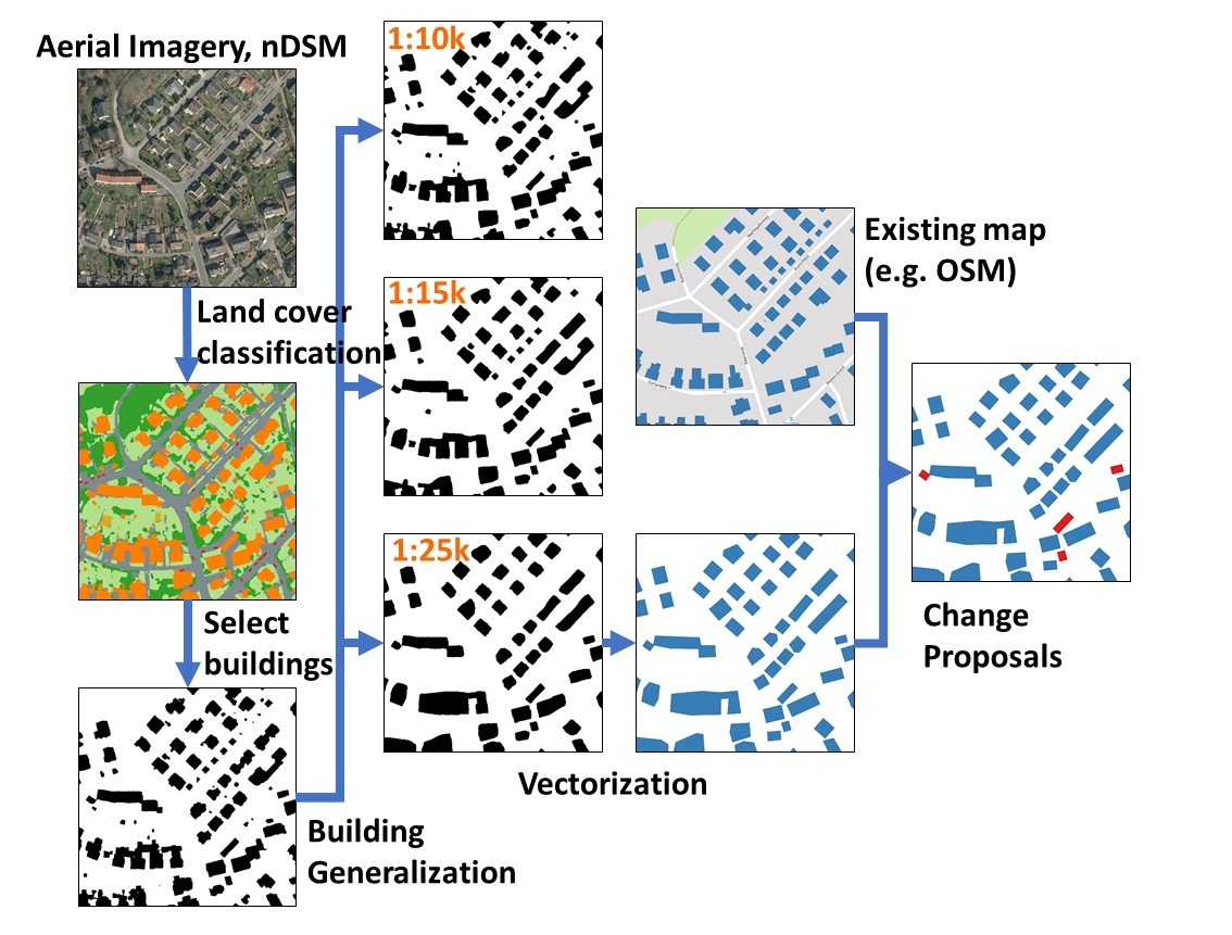
Scale is an important aspect in cartography. From existing maps of different scales, neural network has been used to learn such scale information implicitly. The network can perform generalization directly on the mask output and generate multi-scale building maps at once. In this work, a pipeline method is proposed, which can generate multi-scale building maps from aerial imagery directly. We used a land cover classification model to provide the building blobs. With the models pre-trained for cartographic building generalization, blobs were generalized to three target map scales, 1:10,000, 1:15,000, and 1:25,000. After post-processing with vectorization and regularization, multi-scale building maps were generated and then compared with existing authoritative building data qualitatively and quantitatively. In addition, change detection was performed and suggestions for unmapped buildings could be provided at a desired map scale.
Feng, Y., Yang, C., & Sester, M. (2020). Multi-Scale Building Maps from Aerial Imagery. The International Archives of Photogrammetry, Remote Sensing and Spatial Information Sciences, 43, 41-47.